
In short:
- The South Paris green corridor (Coulée verte du Sud parisien) links Place de Catalogne (Paris 14th) to Massy-Verrières station over 14 km, with about 100 m of climbing and 1 hour to 1 hour 30 of riding.
- Around 12 km run on a car-free greenway of smooth 3 m wide tarmac, with 2 km of compacted sand in Malakoff.
- The route crosses 9 towns in the Hauts-de-Seine and Essonne departments and runs past the Parc de Sceaux, designed by André Le Nôtre, and the Vallée-aux-Loups estate.
- The return is by RER B or C from Massy-Verrières, and the route is part of the Véloscénie, the Paris to Mont-Saint-Michel cycle route.
The South Paris green corridor, a car-free way out of Paris
The South Paris green corridor, known locally as the Coulée verte du Sud parisien, is officially called the Promenade des Vallons de la Bièvre. It was laid out along the route of the TGV Atlantique high-speed line, which heads south-west from Gare Montparnasse.
It is one of the few ways to leave Paris by bike while staying almost entirely away from traffic. For around 12 km, from Malakoff to Massy, the path is reserved for pedestrians and cyclists.
The route crosses nine towns: Malakoff, Châtillon, Bagneux, Fontenay-aux-Roses, Sceaux, Châtenay-Malabry and Antony in the Hauts-de-Seine, then Verrières-le-Buisson and Massy in the Essonne. It alternates between lawns, tree-lined avenues, community gardens and playgrounds.
Its appeal goes beyond a Sunday ride. The route is also the first section of the Véloscénie, the cycle route linking Paris to Mont-Saint-Michel.
Route card: Paris - Massy
| Criterion | Detail |
|---|---|
| Start | Place de Catalogne, Paris 14th (5 minutes from Gare Montparnasse) |
| Finish | Massy-Verrières station (RER B and C) |
| Distance | 14 km, including around 12 km of greenway |
| Elevation gain | About 100 m |
| Altitude | From 26 m to 107 m |
| Duration | 1 hour to 1 hour 30 |
| Surface | Smooth tarmac, 2 km of compacted sand in Malakoff |
| Difficulty | Easy, 2 short ramps |
| Recommended bike | Any bike |
The altitude and elevation figures come from the Véloscénie’s Paris - Massy stage, which records 101 m of climbing and 88 m of descent.
Step by step: from Paris to Massy on the green corridor
The distances below are approximate markers, measured from Place de Catalogne.
Km 0 to 3: Place de Catalogne - Malakoff
The ride starts at Place de Catalogne, behind Gare Montparnasse. The first kilometres use urban cycle lanes in the 14th arrondissement up to the edge of the city.
The green corridor itself begins in Malakoff, near Porte de Vanves. On this section, around 2 km are surfaced with compacted sand, fast in dry weather but slower after rain.
Km 3 to 7: Châtillon, Bagneux and Fontenay-aux-Roses
The path widens and moves away from the buildings. It often splits into two lanes: a footpath, frequently sandy, and a mixed smooth tarmac path shared by pedestrians and cyclists.
In Fontenay-aux-Roses, crossing the railway bridge brings the first short, steep ramp of the ride. Fontenay-aux-Roses RER B station is right next to the corridor.
Km 7 to 10: Sceaux and Châtenay-Malabry
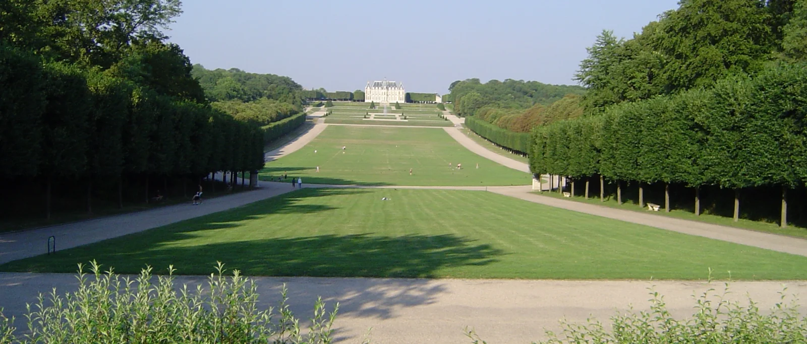
The second ramp of the route is in Sceaux, on Rue Houdan. This is also the most pleasant section: the Parc de Sceaux borders the route, and Parc de Sceaux RER B station makes it easy to stop.
In Châtenay-Malabry, a short detour leads to the Vallée-aux-Loups estate.
Km 10 to 14: Antony, Verrières-le-Buisson and Massy
The final section crosses Antony and then enters the Essonne department at Verrières-le-Buisson. The surroundings become more urban on the approach to Massy.
The route finishes at Massy-Verrières station, served by RER B and RER C. Massy TGV station is a few hundred metres away.
Highlights along the South Paris green corridor
- Parc de Sceaux: 180 hectares designed by André Le Nôtre in the late 17th century for Colbert, with its château, Grand Cascades and Grand Canal. In spring, the park’s cherry trees draw large crowds.
- The Vallée-aux-Loups estate: in Châtenay-Malabry, the house where François-René de Chateaubriand began writing his Memoirs from Beyond the Grave, surrounded by a park and an arboretum.
- The TGV Atlantique line: on part of the route, the greenway follows the railway corridor directly, an often-cited example of urban planning in the Paris region.
Difficulties and things to watch
The green corridor has no major physical difficulty. The two ramps in Fontenay-aux-Roses and Sceaux are short and can be ridden at an easy pace, or walked if needed.
The main issue is sharing the space. The AF3V, the association that lists French greenways, reports conflicts between pedestrians and cyclists on the winding sections near Paris. A moderate speed and a bell are essential, especially at weekends.
The route crosses several streets. The crossings are secured with lights or road markings, but require slowing down at every junction.
Finally, in October 2024 the AF3V reported flooding in the Pont de Pierre underpass after heavy rain. After a storm, it is wise to plan a short detour.
Practical info: access, return and equipment
The start is very well served: Place de Catalogne is a few minutes from Gare Montparnasse, reached by metro lines 4, 6, 12 and 13.
The return to Paris is by RER from Massy-Verrières (RER B and C). Fontenay-aux-Roses and Parc de Sceaux stations (RER B) make it easy to shorten the ride. Rules for taking bikes on the RER vary by line and time of day: check the current conditions before setting off and avoid rush hours.
Most park sections are lit and have benches. The best period runs from April to October, with spring the highlight for the blossom in the Parc de Sceaux.
As for equipment, a city bike, hybrid or gravel bike is the most comfortable on the compacted sand sections.
Variations and extensions
- Out and back: returning by bike on the same path takes the ride to 28 km, a good first target distance.
- A loop of the Parc de Sceaux: from Parc de Sceaux station, a lap of the park is easy to add.
- The Véloscénie: from Massy, the route continues towards Mont-Saint-Michel, with variants via Versailles or Limours. It is an excellent base for a first multi-day trip following a bikepacking guide.
Greenway fans will find more ride ideas in the guide to Alsace cycling routes, and climbers in the guide to Alpine climbs by bike.
Frequently asked questions
How do you cycle from Paris to Massy on the Coulée verte?
The Coulée verte du Sud parisien links Place de Catalogne, in Paris’s 14th arrondissement, to Massy-Verrières station over 14 km, including around 12 km of car-free greenway from Malakoff onwards. The ride has about 100 m of climbing and takes 1 hour to 1 hour 30. Getting back to Paris is easy by RER B or C from Massy-Verrières.
Is the South Paris green corridor hard to ride?
No, the route is easy and family-friendly. Only two short but steep ramps require some effort: the railway bridge in Fontenay-aux-Roses and Rue Houdan in Sceaux. The main thing to watch is sharing the path with pedestrians and crossing streets.
Which bike should you use on the Coulée verte du Sud parisien?
Any bike will do. The cycle path is smooth tarmac about 3 m wide, with only 2 km of compacted sand in Malakoff. A city bike, hybrid or gravel bike is the most comfortable, and a road bike copes without difficulty.